Landing in a French Landmark, Carcassonne
/
On the way to Carcassonne
Read More
Au revoir!
ENGLISH
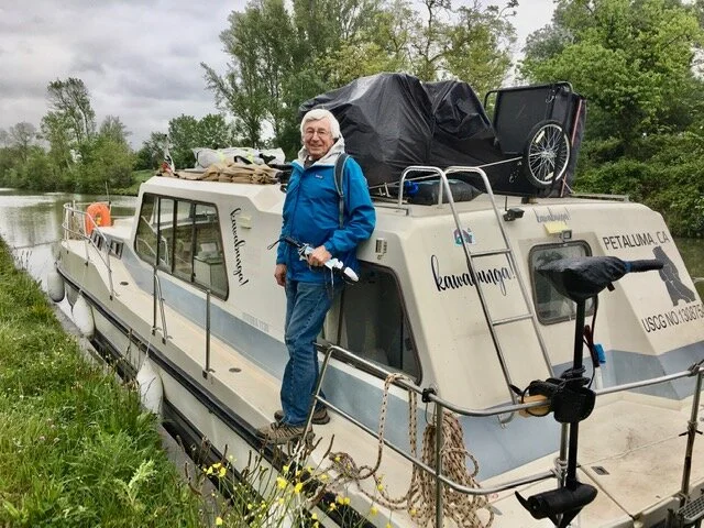
As a journalist, a deadline is a deadline, consequently, when we set April 15 as our departure date, it was written in stone, ready or not. Thanks to the many extra months’ preparedness we were dealt (Covid oblige), hubby’s well trained architectural analytical mind to envision and design mechanical and onboard living scenarios, and my more practical real life household expertise(!), we were ready! Not too many glitches to report after our one month of putting everything in place from our starting point of Buzet-sur-Baïse. (See above map, #1).
As of April 17, we cruised to Moissac (about 45 miles south of Buzet), for A two-night stay, having made our first night stop in the tiny water hamlet of Boé, just south of Agen . The above map shows our starting point, where we intend to travel to the Mediterranean, and eventually up the Rhone River through Avignon to Germany. How far we’ll get this year is anybody’s guess. Experience has taught us that stuff happens along the way (good and bad), so we shall see.
FYI I have a video or two I wanted to post, but apparently I need to learn how to do that with my website uploader. When I figure it out, you will see!
FRANÇAIS
En tant que journaliste, la date limite est sacrée. Nous avions fixé la date du 15 avril pour notre grand départ et il n’était pas question d’y déroger, prêt ou pas prêt.
Profitant de mois supplémentaires de préparation (faute au Covid), et après la mise à contribution des qualités d’analyse et de vie à bord de ma chère moitié, et mon expertise plus matérielle de la vie pratique, nous étions prêts. Peu d’anicroches à reporter après un mois passé à mettre tout en place depuis notre point de départ de Buzet-sur-Baïse. (Voir le plan ci-dessus, #1).
Nous avons atteint Moissac (environ 70 km au Sud-Est de Buzet) le 17 avril après deux jours de navigation et en ayant fait une première étape à Boé, près d’Agen. Le plan ci-dessus vous montre notre point de départ ainsi que notre approche de la Méditerranée et, éventuellement le Rhône à travers Avignon et enfin l’Allemagne. Reste à savoir jusqu’où irons-nous cette année ?
L’expérience nous a appris que nous rencontrerons beaucoup d’imprévus sur notre route, en bien ou en mal, et les plans peuvent changer.
Pour information, j’ai une ou deux vidéos que je voudrais inclure mais, apparemment, j’ai encore a apprendre. Je trouverai !

Leaving Buzet where we had been for almost a month.

Coming up to a lock.

Getting “locked” up.

A “one night stand” in Boé.

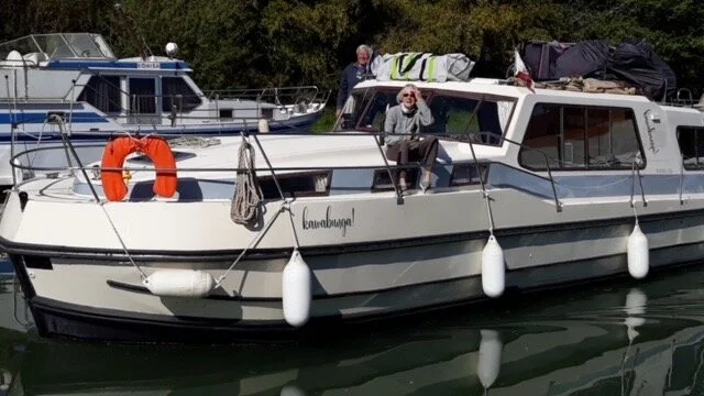
Docked in Moissac for two nights. Leaving Sunday April 18.

Entering a “pont canal,” like an aqueduct for boats. approaching the city of Agen. We were on a water bridge going over the Garonne River.
Adventure website The Lady Alliance features recent travel adventure article by Janis Couvreux.
Read MoreSonoma Magazine’s May-June issue devotes a full page and photo spread to the Sail Cowabunga! adventure.
Read MoreSail Cowabunga! blog posts catches BuzzFeed's eye.
Read More“We followed the contour of the snowbound crater of Mount St. Helens.”

What do Mount Etna, Mount St. Helens, and Saint Peter and Saint Paul Rocks (wait, what's this last one?) all have in common? While the first two are volcanoes, and the third an isolated and strikingly rugged outcrop in the middle of the Atlantic Ocean, they are all grandiose natural phenomena that we managed to scale by either air, land, and sea.
Many years ago we sailed from Brazil to St. Peter and St. Paul Rocks, 15 very tiny rocky outcroppings that lie smack dab in the middle of the Atlantic Ocean, halfway between Africa and South America. They practically sit on the equator, at just slightly over 60 miles north of the line. A needle in a haystack in the grand scheme of the vast Atlantic Ocean, this archipelago is extremely tiny, with its highest point only about 60 ft. above sea level. St. Peter and St. Paul Rocks belong to Brazil and are the exposed jagged pinnacles of an underwater mountain ridge or the “abyssal mantle," that plunges 4000 meters deep into the ocean.
We anchored at the mouth of the bay's guardian pinnacles, and it was like sitting on top of the world. It must have been the closest landscape on earth to resemble what we would imagine the Moon to be. Not a speck of green—no vegetation whatsoever—was to be seen. Course, dark, lava crags jutted out everywhere, strangely coiffed with snowy caps—deep and widespread layers of guano. Birds of all types just swarmed around the Rocks, while the bay was said to be chock-full of sharks. Hoping that the sharks weren’t as numerous as rumors held, we maintained a safe distance anyway: no swimming in this bay.

St. Peter and St. Paul Rocks, Brazil, on the equator, middle of the Atlantic Ocean.
Landing with the dinghy to explore this savage shore was a tricky dance of fancy footwork, trying to gain sturdy footholds in the rock face that we tied up to while negotiating a heaving swell. Once we thrust ourselves over the rocky ledge, we were surrounded by an eerie and breathtaking landscape of a wide rocky plateau, dotted with innumerable tidal pools. The plateau bristled with a gleaming carpet of peculiar one-armed crabs, winding around and around waving their single “menacing” claws (which were quite cute). Flying fish that had flown too high dotted the rocks. Spectacular and noisy waves crashed over the cliffs, rocks, and pinnacles, and our view of the landscape from our anchored boat was confirmed: there was no vegetation whatsoever.
Numerous and aggressive, the bird population lived up to their reputation as they attempted to overpower and threaten us. They had no fear of humans, since they rarely had contact with such a beast. They would rush, dive-bomb, and cackle, and those with their young in nests, were more acutely aggressive. After a while, we all seemed to reach an acceptable truce as a certain invisible barrier was established. One step beyond that frontier, and off they re-launched into attack mode.
Years later we marveled from aloft with a 360° view of Mount St. Helens, Washington, while nestled in a small private plane circling the rim of the volcano. It was a rare crystalline Pacific Northwest winter day in January, devoid of a single cloud. Taking off from Hood River, Oregon our pilot flew due west and we were immediately surrounded by an unparalleled panoramic view of multiple majestic volcanic white sentinels that jutted up from the Earth's floor. Behind us Mount Hood and Mount Adams flanked the Columbia River Gorge, Mount Jefferson reigned in the distant southeast, and Mount St. Helens loomed smack dab in the center of our windshield like a bulls-eye. Mount Rainier shadowed Mount St. Helens in the near background.

As we followed the contour of the snowbound crater of Mount St. Helens, we were starkly reminded that it was still vitally active. A distinct plume of smoke wafted from the bottom of its hollowed-out center, like steaming gravy rising up from the dimple of a scooped out mound of mashed potatoes. A log-jammed lake on the volcano's flank was all that was left of a forest toppled and frozen in time since the 1980 explosion. The crispness of the day, of the sparkling snow, the shifting peaks at our eye level made it feel like we were in in a life-sized 3D diorama, or a National Geographic film extravaganza spilling from an Imax screen.
Recently we ventured to Mount Etna in Sicily—an entirely different active volcano experience. About an hour's drive outside the seaport of Catania and all its cacophony, our ascent to Mount Etna was a pleasant drive via a gradual uphill grade through villages on back country roads. The richly-colored earthen and multi-mineral hued nuanced folds of the crater's skirt cascaded softly down to the staging and cable car landing area at Rifugio Sapienza where we parked our rental car. Although this late Sicilian September day was 80 degree-plus, we easily donned jackets once we alighted here. We boarded the cable car and slid up the mountain to the waiting monster passenger four-wheel drive "truck buses" for the last few miles to the top, and a closer view of the mountain. Bobbing inside these massive oversized vehicles, we zig-zagged up the winding switchbacks to a plateau at nearly 10,000 ft. where Mount Etna loomed above our heads poking in and out of undulating wispy feathered clouds.

Unlike Mount St. Helens and other volcano profiles, much of Mount Etna's surrounding terrain wasn't jagged and rugged but exuded a soft and cozy yet eerie eminence. Like huge mounds of freshly ground coffee, or heaps of just-dumped enriched garden potting soil, this mountain beckoned us to plunge our arms elbow deep down into its velvety-looking earth. Walking along a ridge, we skirted occasional plumes of smoke that wafted out of this "fertilizer." We could feel the warmth on our hands as we laid them on the ground in those spots.
From Rifugio Sapienza, one can also hike two hours up to the top, but we were intrigued to ride in one of these monster trucks so we opted, instead, to walk back down and sink our feet into the supple dirt. On March 16, 2017, just six months after our visit, this largest active volcano in Europe erupted.

We all hear the many voices that tell us to "Just go," and "Pull off those blinders; see the world." Alas, it's not always that easy. When we get out of our own way we can truly see how small we are, and how expansive the Earth is. There are so many ways to get to the tops—and there are so many of them—all around us. We were on them, over them, and through them. Even just a day hike can take you there—spot on.
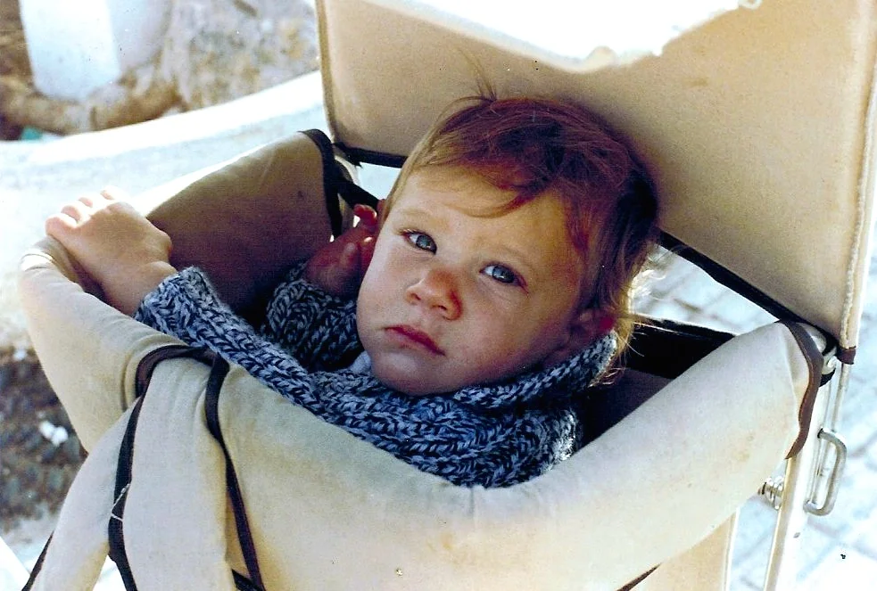
While preparing coffee, I glimpsed Brendan scrambling up the ice chest. I yelled for him to stop, but he was over the net and in the water with a big splash in two seconds flat!
Read MoreWe couldn’t resist the opportunity to stop at Devil’s Island...infamous from 1854 to 1952 as one of France's most notorious prisons, or "hell on earth."
Read MoreThey were one grand, wet, rambunctious, laughing amoeba of towheads, redheads, arms, and legs. They cackled in accented English, French, and Spanish, swimming and jumping helter-skelter.
Read MoreBarely out of Florianopolis, we were tossed around violently—a cork on a wild sea of foam, with 50 knots of wind. As the sea grew more frenzied, I became alarmed, and I seriously wondered if Cowabunga was going to pull us through intact.
Read MoreJanis Couvreux is an author, journalist and blogger. Her most recent work is the memoir: "Sail Cowabunga! A Family's Ten Years at Sea."
Sail Cowabunga! A Family's Ten Years at Sea, Janis Couvreux is a journalist, sailor, mom, grandmom, traveler, and Franco-American, who has blogged at the Huffington Post about living bilingually, crossing oceans, backpacking adventures, and raising kids outside the box.
You can also find Janis on Facebook | Instagram |
Copyright © 2023 Janis Couvreux & Couvreux Editing. All Rights Reserved.
Powered by Squarespace & Designed by Christin Couvreux